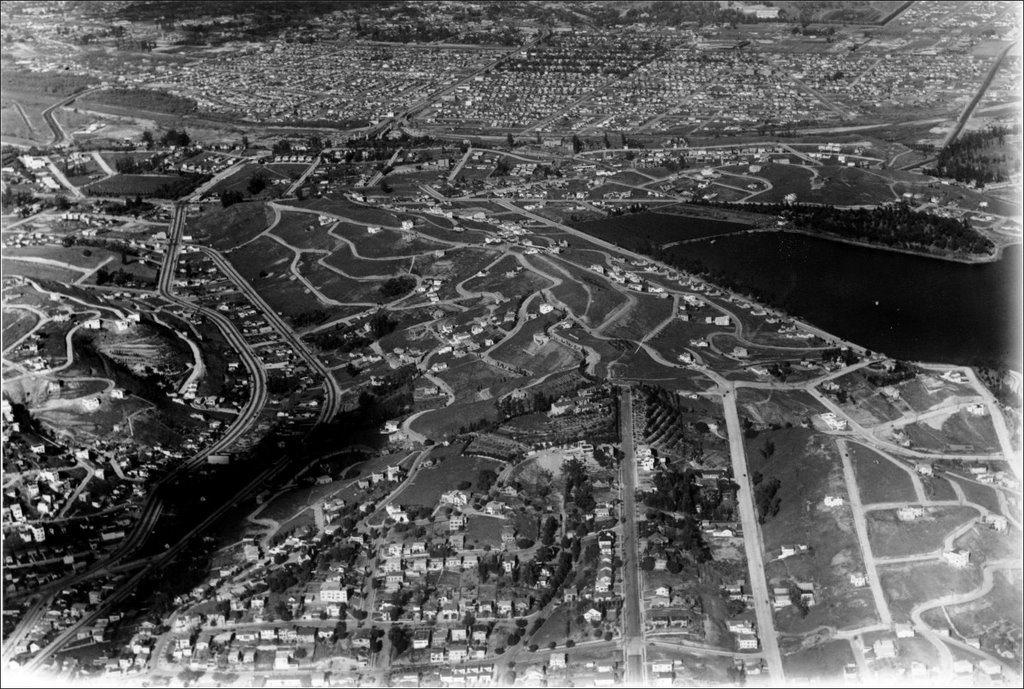
From a historic site, above is a northeast aerial view looking from Silver Lake toward Atwater Village (at the top). This is February 1929, the month of the first Academy Awards. Look how densely developed AV already was, compared to the sparseness of Silver Lake. Many of those AV homes still stand.
That's Hyperion and Griffith Park Avenues along the left, crossing each other toward the top (just like a few other "parallel" Los Angeles streets). The LA River runs left to right, just below Atwater Village.
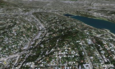
Below, a similar, yet less elegant, aerial vision from Google Earth today. Look at Silver Lake's development in the last 77 years. Atwater Village, if it weren't so fuzzy in this image, would look about the same.
3 comments:
Difference between the two photos? About 1000% more hipsters!
wow, kudos on anglerecreation, that's an awesome comparison.
Thanks! I was disappointed how Google Earth dropped resolution on Atwater Village at the top of the image. Just goes to show you can't replace good ol' film for aerial shots. Yet.
-AVN
Post a Comment