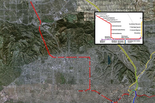
| LA City Nerd notes today that the official Los Angeles Metro rail map is "quite contrived: straight lines and perfect angles make up the maps of the winding tunnels and tracks." A Nerd reader wonders, "What's the real path of the Red Line?" The Google Earth version seems closer to reality. Though it has yet to break off the Purple Line spur from its maiden Red Line roots, Google draws twists and turns where it should. Unlike MTA, for example, Google shows an east-west line as the train follows Hollywood Blvd. Google Earth is free to download. Zoom in to Los Angeles. Turn on the "Transit" layer. Get real ambitious and turn on the roads layer. It'll blow your mind.
|
2 comments:
That still can't be right. I don't think the train can make a sharp left or right turn between Vermont/Sunset and Hollywood/Western. It would go off the rails. It has to be more of a smooth arc between those two stops.
You're right, that's a pretty sharp turn. It would at least throw everyone to one side of the train. (Could it maybe be closer to the station, when the train wouldn't be traveling that quickly anyway?)
Post a Comment